 |
||||||||||||||
| PRODUCTS | ||||
| Conductivity Meters | ||||
| Metal Detectors | ||||
| Time Domain Systems | ||||
| VLF Systems | ||||
| Borehole Probes | ||||
| Data Acquisition | ||||
| Software | ||||
| DAT | ||||
| GSPX7 | ||||
| Third Party Software | ||||
DAT software is designed to manage and process data from any Ground Conductivity Meter or Metal Detector collected with any of the DL720, DL600 or DAS70 Data Acquisition Systems. DAT programs are individually named to reflect the instrument supported (e.g. DAT31W, DAT34W, etc.).
DAT programs facilitate the transfer of data from any supported acquisition system to a personal computer. After transfer, functions are available to review, position, edit and present data in either tabular or profile format. Routines are also available to format data files specifically for export to Third Party Software.
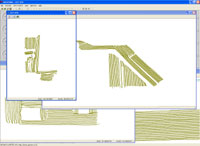
Functions for data positioning address methods of data collection that either include, or do not include GPS data. Without GPS support, Auto Mode data collection, with fiducial markers, is common; positioning of markers and alignment of line ends, even in the case of large-area surveys, is simple and efficient.
Positioning routines are enhanced by the simultaneous collection of GPS co-ordinates. Geonics data acquisition software supports two methods of GPS data collection. One method requires that EM instrument and GPS satellite data are collected separately on dedicated acquisition systems. Provided that the internal clocks of the instrument acquisition system and the GPS satellite time can be accurately synchronized, a processing routine combines the two independently collected data sets into a single XYZ data file.
The second, more accurate method is supported only by data collection with the Allegro (or similar) field computer – a component of the DAS70 Data Acquisition System – wherein both EM and GPS data are simultaneously collected to the same data file, in the same data acquisition system.
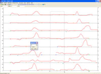
Data is presented in profile format – an important presentation for data interpretation, providing information in detail that might be unseen by other methods of presentation. Data are displayed in accordance with the parameters for data collection specified by the operator. Each profile line, which can include an unlimited number of segments, can display as many as eight (Conductivity Meter) or six (Metal Detector) individual traces: e.g. one each for Conductivity Meter quad-phase (conductivity) and in-phase (susceptibility) from both vertical and horizontal dipole modes, from each of two separate instrument orientations.
Data can also be easily formatted, as an XYZ file with either geodetic or UTM co-ordinates, as available, for transfer to third party software (see Third Party Software) for additional methods of interpretation and presentation.
Click any image to enlarge
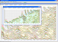
DAT61MK2 Profile View
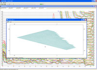
DAT61MK2 Creating XYZ File
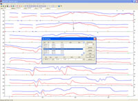 DAT61MK2 Editing Data
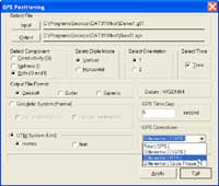
GPS Positioning window
GPS Based Survey Display
DAT38W Positioning Markers